All-inclusive software, is used to view historical data, run diagnostics, configure and set alarm levels for our Flying laboratory units.
The Scentroid Drone Information Management System, DRIMS2, Scentroid all-inclusive software, is used to view historical data, run diagnostics, configure and set alarm levels for our Flying laboratory units. Provided as part of the flying laboratory package, the software is installed on our onboard server (default), Scentroid’s cloud-based server (default) and on your localized server (optional).
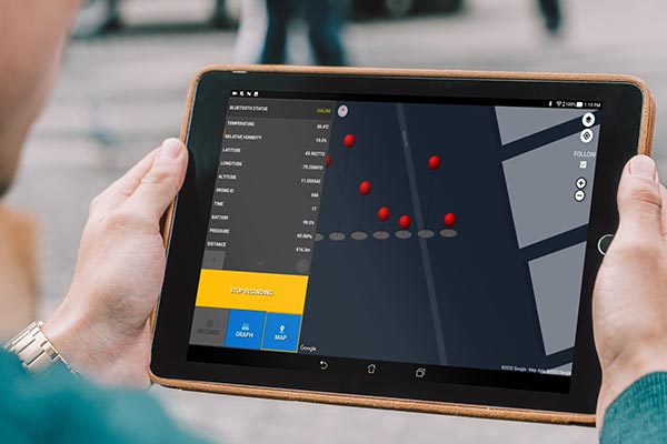
DRIMS2 Ground Station
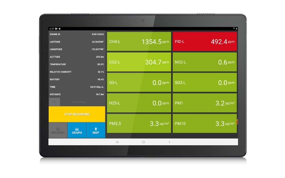
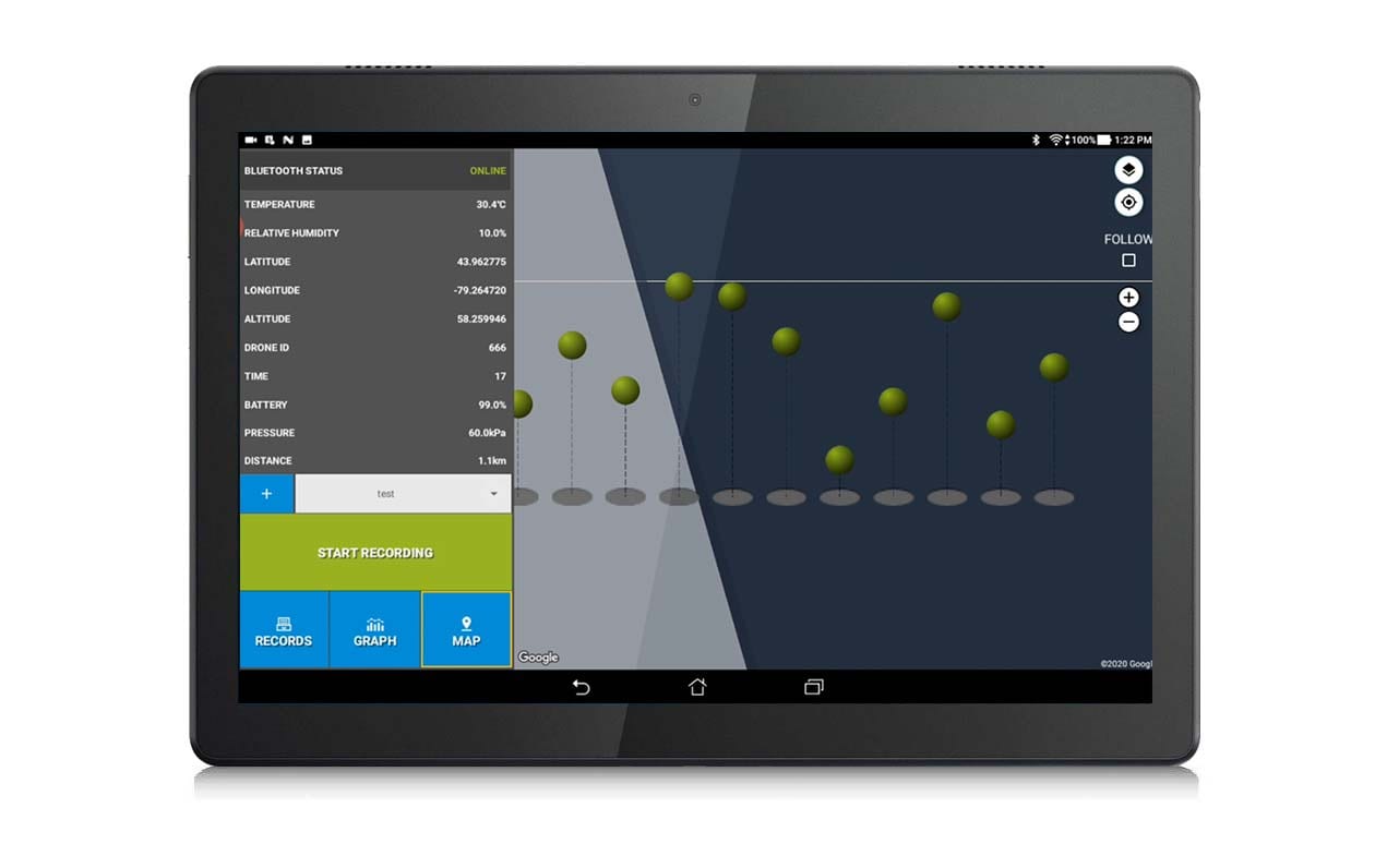
Ground station app will serve as your primary assistant with any Scentroid flying laboratory unit. This handy app includes all live data as well as historical data for sensors, including GPS position, altitude, temperature, and humidity.
DRIMS2 Sampling
The user can also command the drone when to take a sample and when to perform routine maintenance such as calibrating sensors. The readings are continuous, and the user can choose whether to display them live with our diagnostics feature or forward it to a database. Furthermore, an easy data re-calibration option is available to ensure you are receiving the latest results.
Advanced Mapping Solutions
The DRIMS2 software also provides a 3D live mapping of all your readings. The system can provide an auto generated isometric map displaying altitude, along with an auto generated heat map.
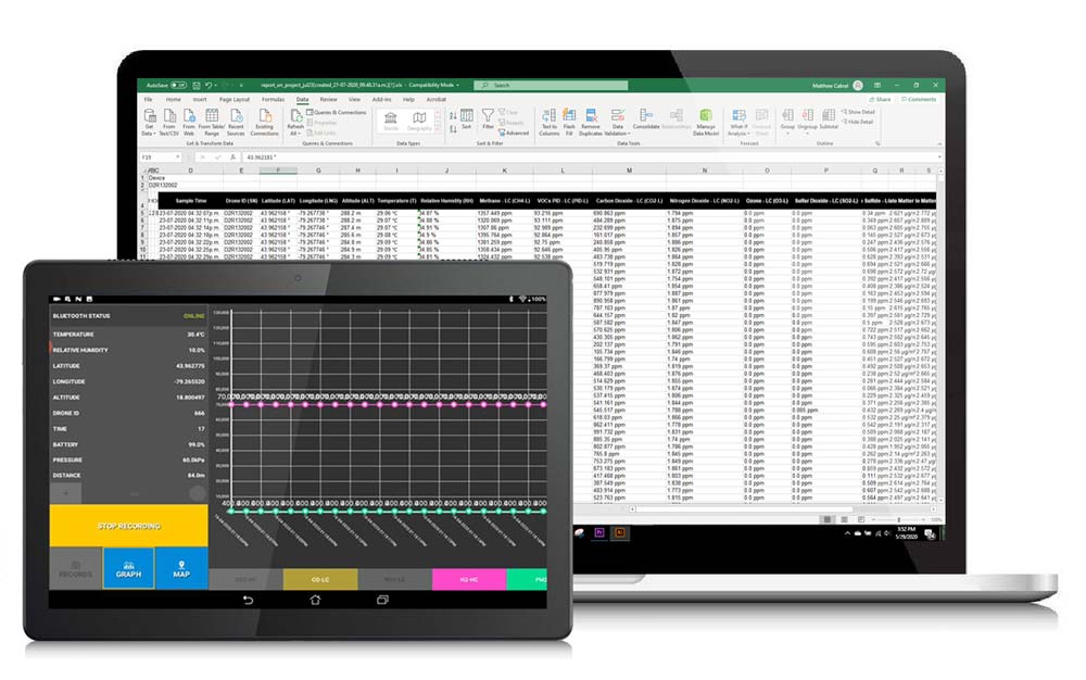
Data Analysis & Graphing
Grazie alla sincronizzazione automatica con il software cloud DRIMS2, l’esportazione, il trasferimento e il backup dei dati è semplice. Il software DRIMS2 permette di visualizzare i dati di volo/progetto attraverso un’interfaccia grafica di facile lettura, e allo stesso tempo consente l’esportazione di tutti i dati in un file Excel come un insieme di valori medi per volo/progetto.
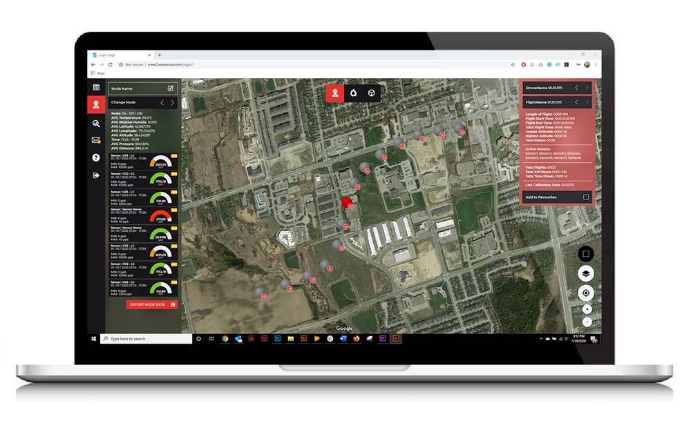
DRIMS2 Analysis Software
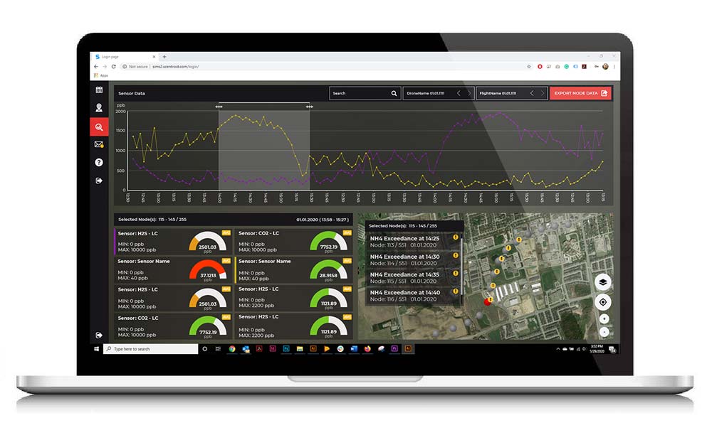
DRIMS2 Analysis software serves as the perfect companion to any monitoring job – an offsite wealth of information is stored in a beautiful and easy to navigate interface. Access all of your historic records, alarms, and completed flights from any location with an active internet connection.
After securely logging in, users can select their drone, their flight / flight date, name, or even search for a specific sampling node. Our brand new ‘favourite’ system allows you to quickly save and access a specific node of your choosing with just a click of a button.
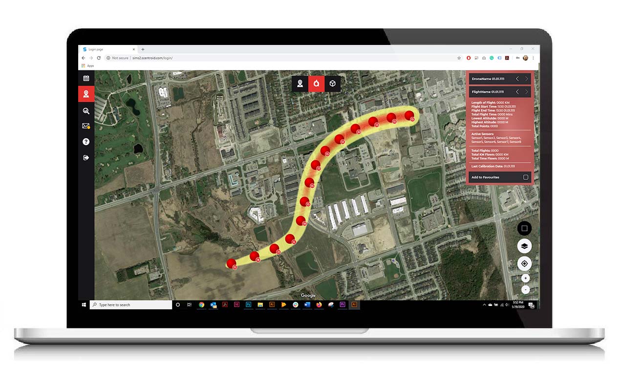
Advanced Mapping Solutions
On top of traditional mapping, the DRIMS2 software is able to provide 3D mapping of your readings. The system will automatically generate and display an isometric map in order to display the altitude of each sampling node. The analysis software is also capable of displaying a heat map of your flights.
With access to a heat map along with viewing altitude in a 3D setting, managing a sensory project has never been easier.